25 Manuscript Maps of Oaxaca, Mexico
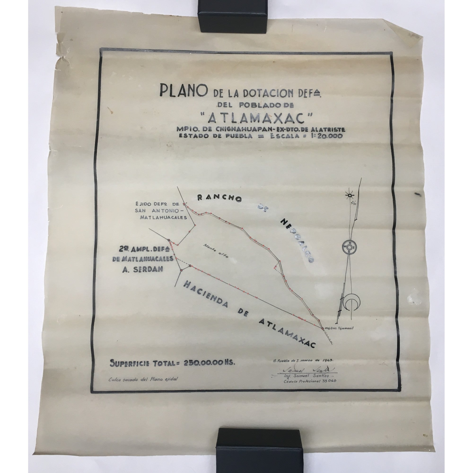
Archive of Manuscript Maps for a "Plano general de ocho fracciones boscosas de propiedad partical" and Related Projects
Notes: Twenty-five manuscript maps, mostly on vellum drafting paper. Sizes range from 8 by 14 to 21 by 42 inches. Fifteen are smaller sizes and ten are larger sizes.
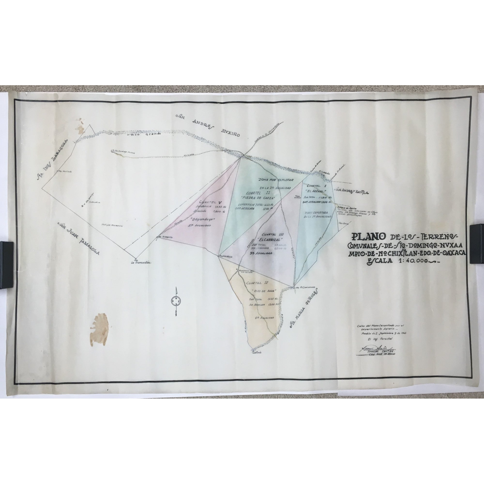
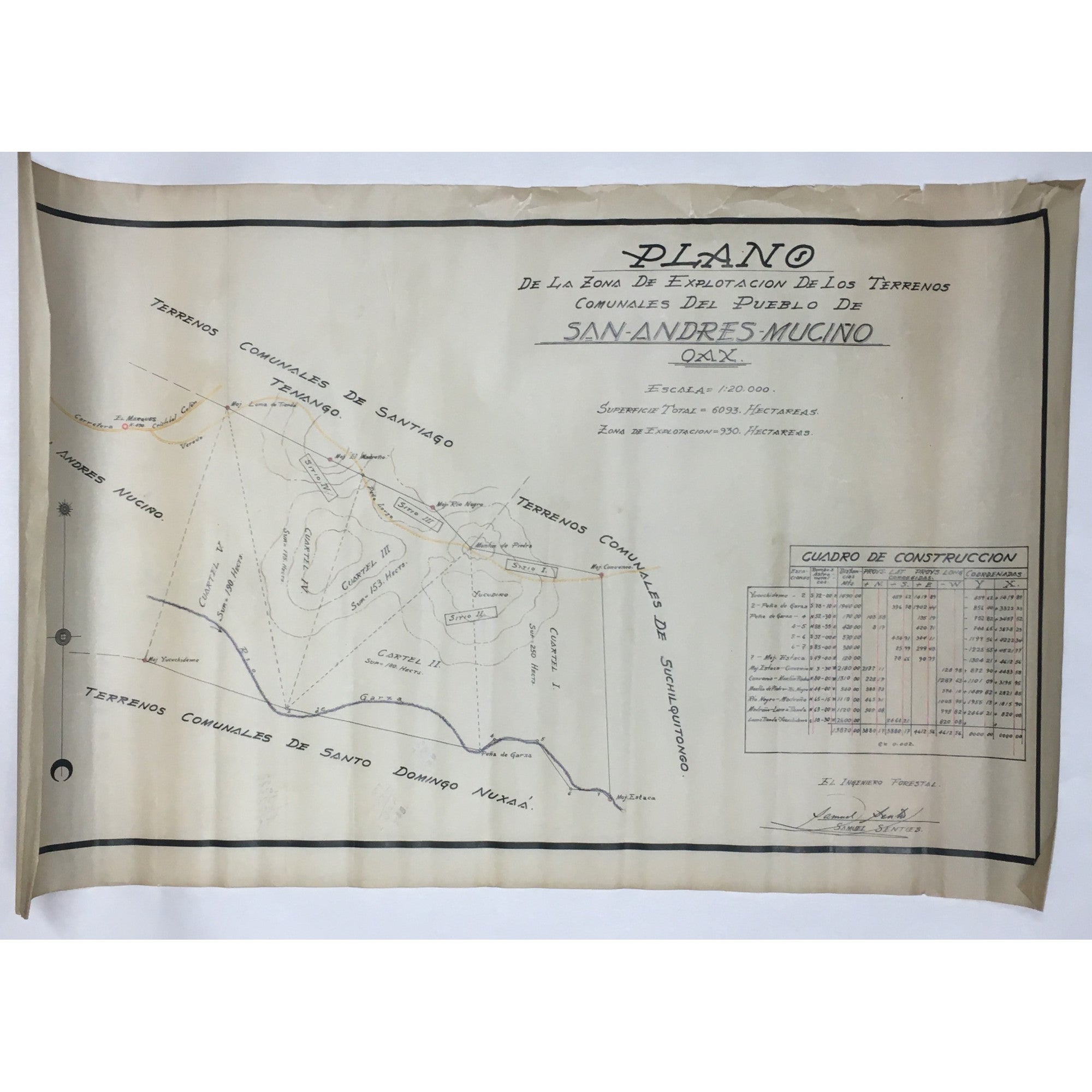
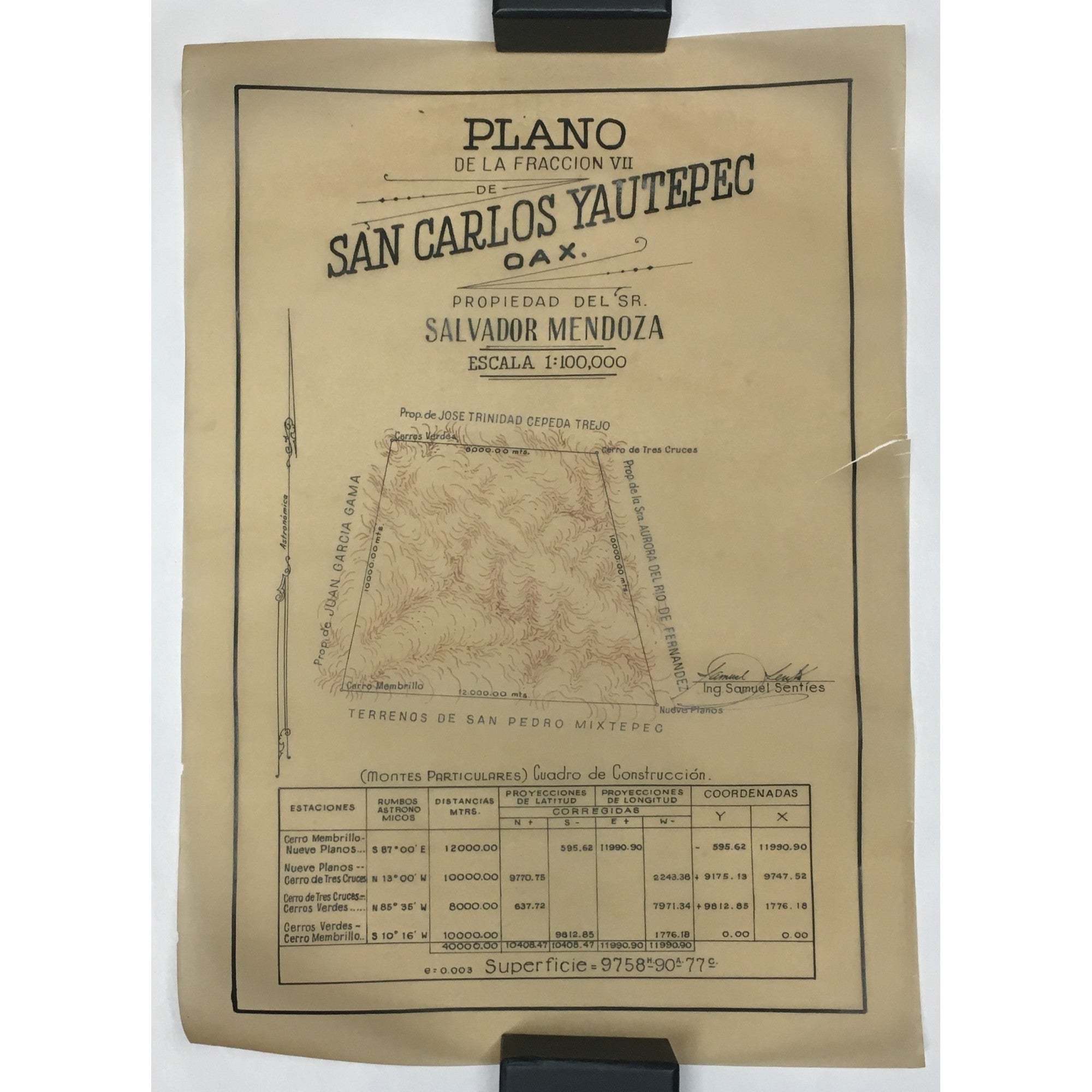
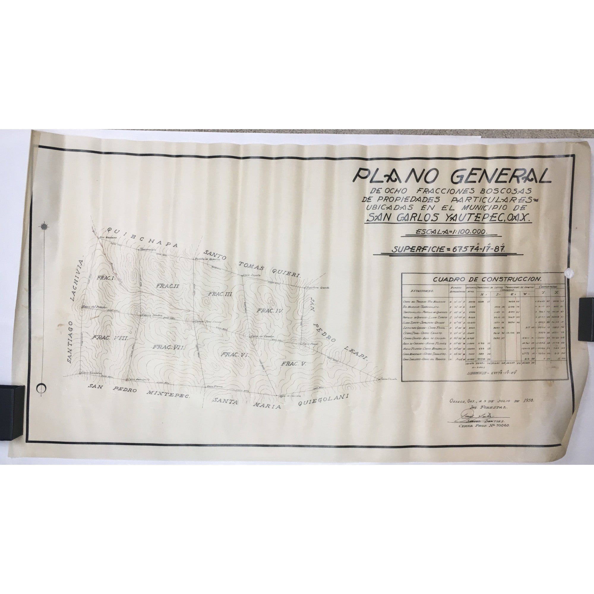
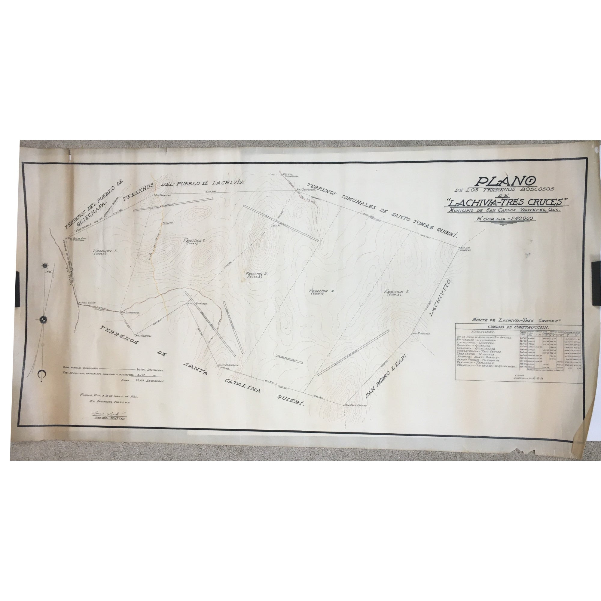
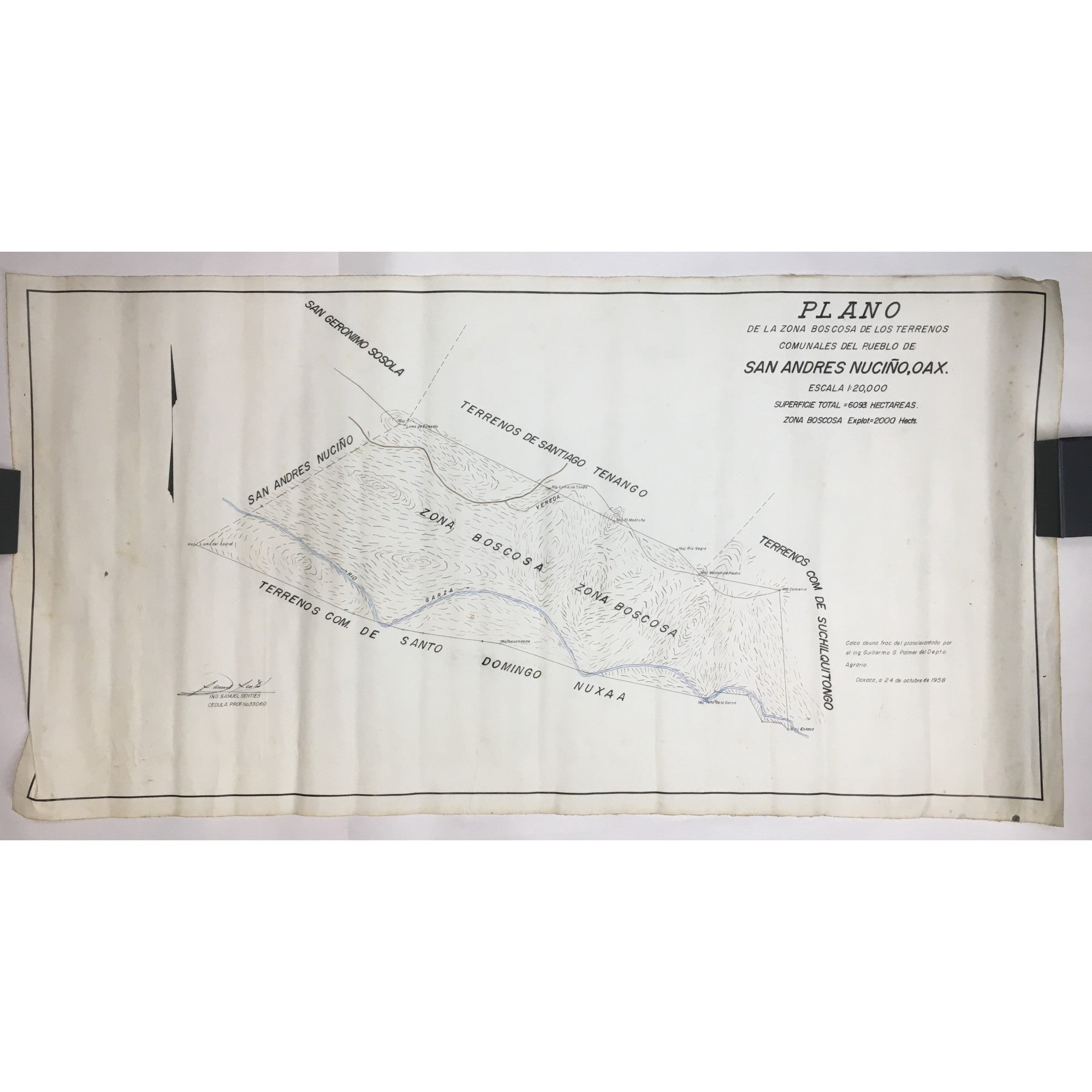
These are surveys of forested private property in the Mexican state of Oaxaca prepared by forestry engineer Samuel Senties. The maps show property lines, ownership, and the relation of private lands to communal lands. The maps appear to be parts of a project titled, in English translation, General Plan of Eight Forested Sections in Private Ownership, with related maps drawn in the years immediately before and after.
Edition + Condition: Maps tanned; some with edge tears, but generally very good.
Publication: Oaxaca, Mexico: 1950s.
Item No: #306803
Sold