Rare Map Printed from Type
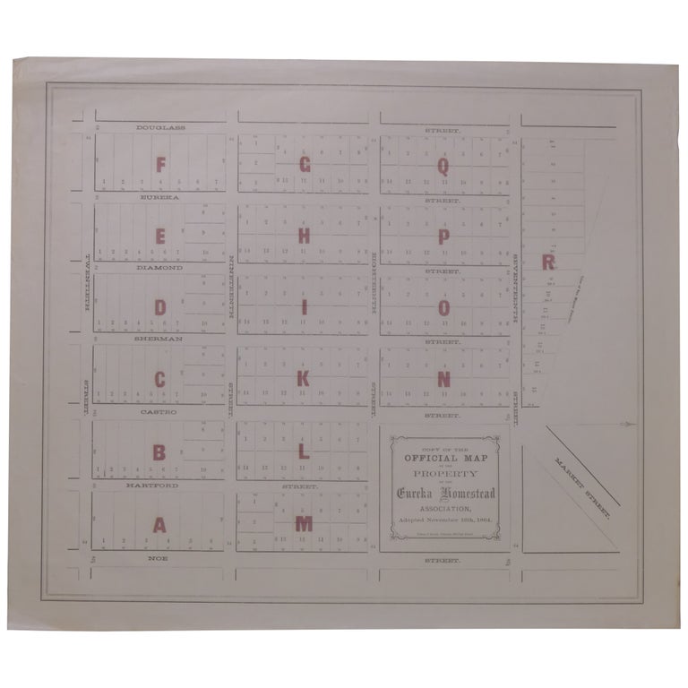
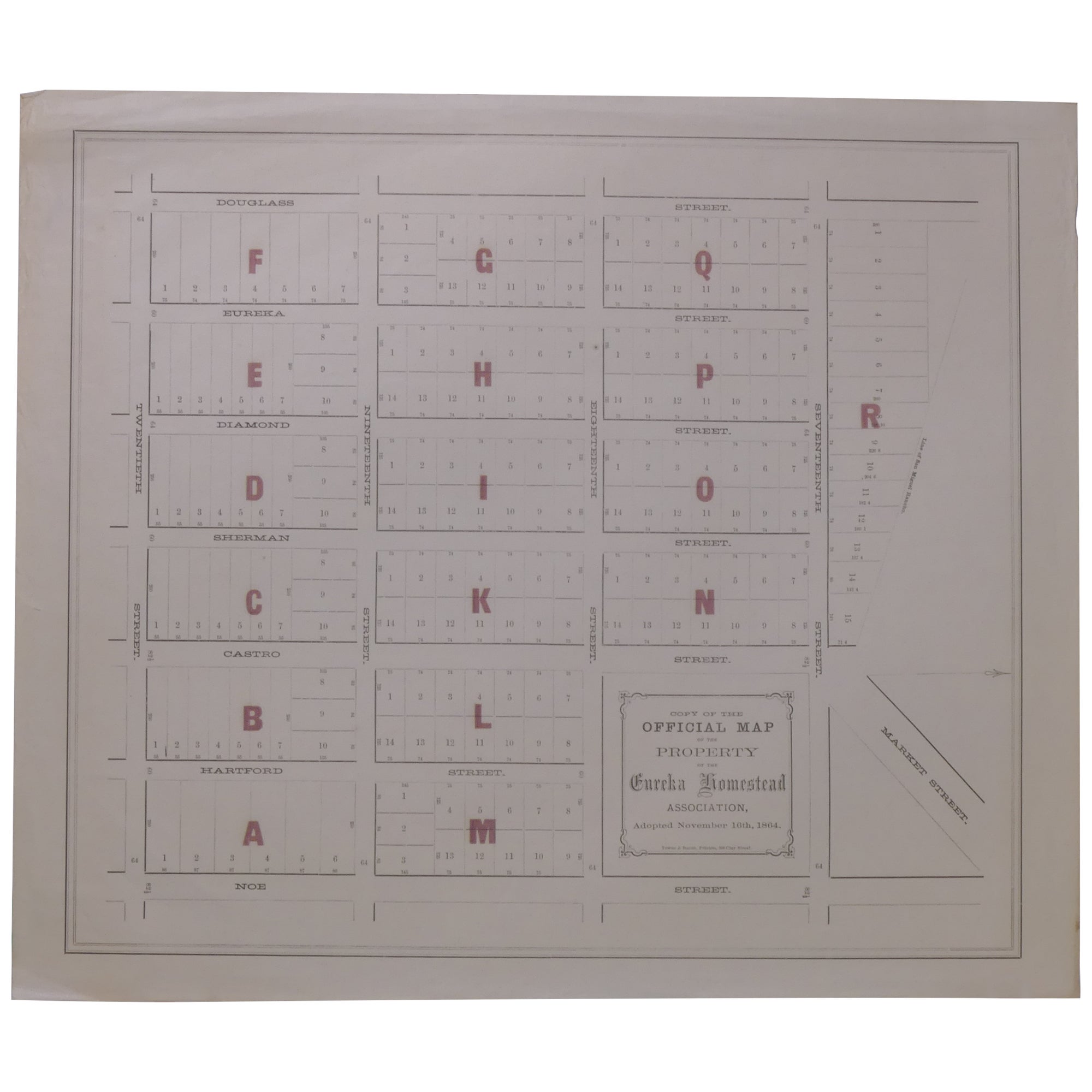
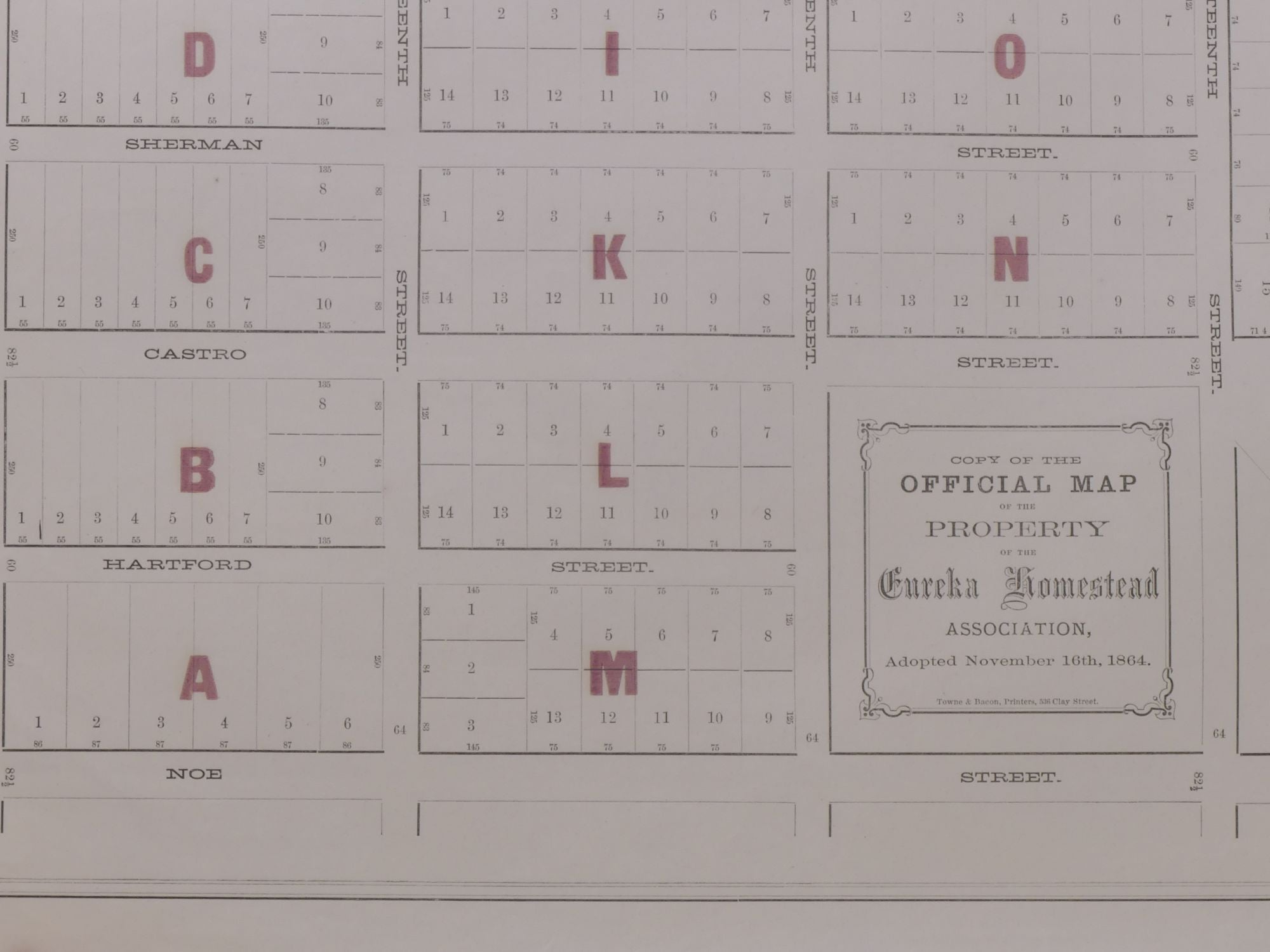
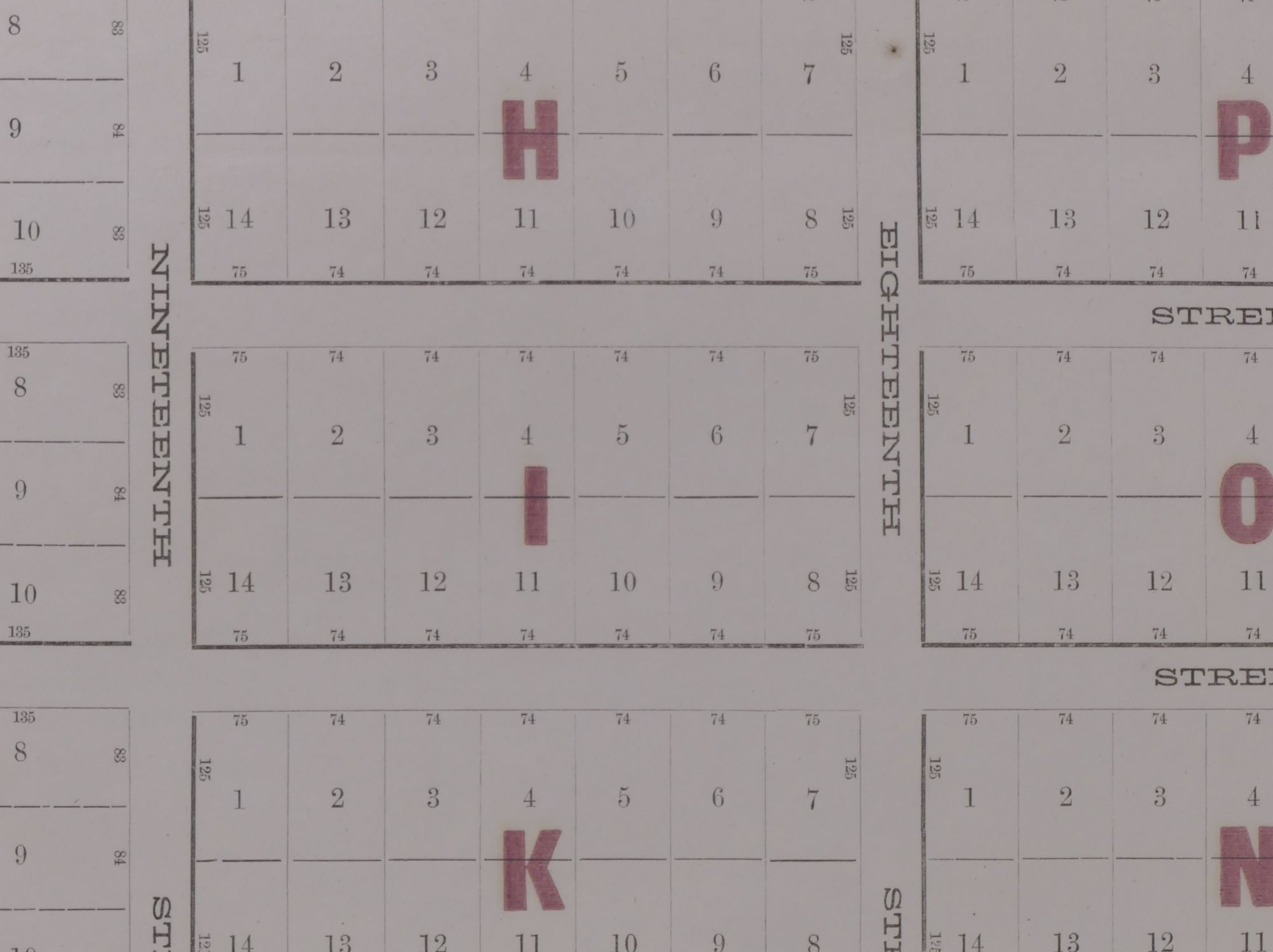
Copy of the Official Map of the Property of the Eureka Homestead Association, Adopted November 16th, 1864
Publication: [San Francisco]: Towne & Bacon, Printers, (n.d. but probably 1860s).
Notes: A very unusual original (not a copy, despite the title) promotional real estate map for San Francisco's Castro district. While this map has been described as a lithograph (see PBA Galleries, April 21, 2022, $1,375), it is actually letterpress printed entirely from type elements (the bite of the type can be distinctly felt on the verso of the paper). It shows the lots in the neighborhood bounded by Douglas, 17th, Noe, and 20th Streets.
The Eureka Homestead Association was one of many speculative real estate ventures sweeping San Francisco in the early 1860s. In 1863, the Alta California newspaper reported on homestead association, including the Eureka Homestead Association:
"These societies are nominally formed for the purpose of supplying the members with homesteads but a homestead implies a dwelling which none intend or attempt to furnish. The real purpose is to purchase land in a large tract and subdivide it among the members and thus enable them to get lots suitable for homesteads at a less price than they would have to pay if they should buy separately. Most of the members have no intention of making their homes on the lots and the object of the organization of the companies therefore is mainly a land speculation. In most of the companies there is a monthly assessment of ten dollars and by these payments continued regularly for several years poor men are enabled to invest their savings in real estate which bill almost certainly prove profitable in time." (Quoted in the Sacramento Bee, 5 January 1863).
This map reproduces the original hand-drawn map filed with the County of San Francisco Assessor to establish property boundaries. The present map was undoubtedly printed to promote sales of the lots.
Roughly 19.5 by 16.5 inches, including margins. Printed in black with block labels in maroon ink.
Edition + Condition: Edges wrinkled, with a few short tears. Generally near fine.
Item No: #283864
Price: $500